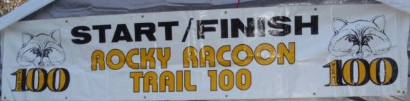
Rocky Raccoon 100 is where it all began for me back in 2005. This was the scene of the crime where I finished my first 100-mile race in 26:53. I returned for the 4th time, this time seeking my 38th 100-mile finish. Last year I had a nearly perfect race, finishing in 21:07.
The Rocky Raccoon 100 runs in Huntsville Stake Park, north of Houston, Texas. The 20-mile course runs all over the park, making its way all the way around Lake Raven. We would have to run the course five times to reach 100 miles. The course had been changed in recent years to eliminate two out-and-backs, replacing them with more forest single-track. Most of the course runs through forest on a nice soft surface. See the course map.
I’m a new race director in the sport of ultrarunning. I never envisioned that I would be a race director and never really sought after doing it, but as I wanted to share the experience of ultrarunning with others, I eventually took the plunge and started to direct a race. However, I did not just jump into it, I did it after serving several years in an “internship” helping and watching a race director who I think is one of the best in our sport. Still, I feel like a rookie race director and I’m still learning.
The sport of ultrarunning is unique in that it has no governing body looking over it. Some may believe the USA Track and Field organization (USATF) does, but in reality this body doesn’t even understand the sport and in recent years seems to get in the way more than help. They try to anoint national championships that are largely just ignored by the mainstream competitors of the sport.
So without a true governing body, race directors can have an enormous impact on the sport. In recent years, there has been an explosive growth in the number of ultramarathons and thus an explosion of the number of race directors who are impacting the sport. Thankfully, the vast majority of these race directors are ultrarunners or have experienced ultrarunners on their committees and are being careful to provide what is expected and maintain a level of uniformity.
To close out my 2010 racing schedule, I decided to give a fixed-time 48-hour event a try. I entered Across the Years (ATY) 48-hour footrace held at Nardini Manor, in Buckeye, Arizona, west of Phoenix. For a fixed-time race, you try to cover as many miles as you can in that period of time. The clock is always ticking. Each year ATY attracts many of the elite in sport from around the world. Two years ago I ran the 24-hour version of the race and did pretty well, so this year I wanted to see how I could do in the 48-hour version.
Capitol Reef National Park is one of the lesser-known parks in Utah. The park is in a remote area of south-central Utah that did not have a paved road going to the area until 1962. In 1971 President Nixon signed a bill to make the area into a national park. This park is still a relatively secret national treasure compared to the other well-known parks in Utah. It is an ultrarunner’s paradise because of its solitude, spectacular scenery, primitive and rugged trails, slot canyons, and gorgeous slick rock.
The major feature of the park is the Waterpocket Fold. This is a remarkable, nearly 100-mile long up-thrust extending like a rugged spine from Thousand Lake Plateau southward to Lake Powell. On the east side of the Waterpocket Fold is an extremely long valley that extends the length of the Waterpocket Fold. Bordering the east side of the valley are high cliffs of Halls Mesa. Winding through the valley is Halls Creek normally dry but runs full of water during flood run-off times. This valley can be brutally hot during the summer and surprisingly warm in the winter.
In 2007, I attempted to run a double crossing (R2R2R) of the Grand Canyon from the North Rim to the remote, primitive, Boucher Trail on the South Rim and back. During that adventure, I reached Boucher Creek, but turned back without climbing up to the rim. I desired to try again to conquer that very long 90-mile double crossing this year. But the weather didn’t cooperate because of a record arctic cold front.
The forecast improved so Thanksgiving afternoon I decided to go ahead and travel to the Grand Canyon to do my run. But, as I approached the North Rim entrance at 7:30 p.m. I went through dangerously cold pockets of air. It got down to -18. That is minus 18 F!! It really freaked me out. I envisioned finishing my 90-mile run in below-zero temperatures moving very slowly up the North Rim. What if the car wouldn’t start because of the bitter cold? No one would be around to help because the services at the rim were closed. I decided to turn around at the North Rim entrance. I wasn’t willing to take on that danger.
My route in green
Instead, I decided to make the long drive around the canyon to the South Rim and then do a shorter but amazing run during the next day when it would be warmer. My new plan was to do a giant loop, descending down Bright Angel Trail, heading west (down river) on the primitive Tonto Trail, go up the rough Boucher trail to Hermits Rest, and then either run 8 more miles on the rim back to my car or take the shuttle back. This would be normally a 4-day backpack trip. I hoped to run it in about 12 hours.
The Antelope Island 100K is a new race held on the largest island in the Great Salt Lake in Utah. The state park there is very supportive of this and the other trail races that Jim Skaggs puts on there because it introduces this unique park to so many people.
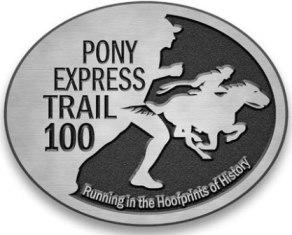
This year is the 150th anniversary of the establishment of the Pony Express which captured the imagination of the country. In 1860 the Pony Express greatly sped up cross-country mail delivery using courageous endurance riders who were “young, good horsemen, accustomed to outdoor life, able to endure severe hardship and fatigue, and fearless.” One hundred fifty years later, 38 endurance runners retraced the hoof prints of history by participating in the 5th annual Pony Express Trail 100-mile and 50-mile endurance runs.
The race runs on the historic Pony Express Trail, in the very remote stretches of western Utah. It passes by five Pony Express station sites along the way marked by huge monuments. Each runner is supported by a crew and staggered starts are used (slower and faster groups) to spread the runners out on the desert floor. They all converge about 50 miles out, with views of expansive salt flats in the distance.
The Bear 100 was the first 100-miler I attempted back in 2004. It was a small event that year with 51 starters. At mile 87 after 30 hours of running/hiking, I found myself in last place with very little energy left. I asked my pacing friend to flag down an ATV or motorcycle to help get us to the finish. At the finish line, I watched other runners finish their 100-miles. I shook my head and told my family that this race was way over my abilities, that I could never finish it. But in 2010, I was back again to challenge “The Bear” for the 7th time, seeking my 6th finish.
The Wasatch Front 100 is the premier ultramarathon locally. It is in its 31st year and is a labor of love for many of the founders of ultrarunning in Utah. It is thrilling to just watch and observe their dedication and efforts to pull off an amazing event like this. This was my 3rd year running Wasatch 100. I don’t run it every year, some years I have run other races in its place. But it is great to run on the trails with so many local runners and others from out of state who have flown in to experience the majestic Wasatch mountains.
The Bear River – Smiths Fork Trail (#091) (Also sometimes referred to as the North Slope Trail) is a long-forgotten trail in the Uinta Mountains that crosses the North Slope from west to east. This mostly forest trail connects seven river forks, and climbs up and over six major ridges. It covers nearly 30 miles with climbs totaling more than 7,000 feet. The altitude for the route is between 8,800 feet and 10,800 feet.
A week ago, I went backpacking for five days in the High Uintas in Utah. While there, I discovered a nice challenging trail on the North Slope that runs west to east, up and over the ridges, and across the canyons. This trail is named “Bear River – Smiths Fork” trail because it runs from Bear River on the west all the way to Smiths Fork on the east, probably about 35 miles or so. On our last day of the backpack, we ran 11 miles of it between East and West Blacks Fork Forks.
map of my route
I wanted to get in one more long training run before the Wasatch 100 in two weeks. I wanted my run to have lots of climbs at altitude, so I decided to try running this trail starting at Bear River, up three major ridges, and then summit Mount Tokewanna, the 11th highest peak in Utah. I would then return the way I came, for an adventure of more than 40 miles. I fully realized that this would be tough, especially since much of the trail would travel through an area destroyed by forest fire in 2002.
The Uinta mountain range in Utah is one of the few ranges in North America that runs east to west. This mountain range contains all of the Utah peaks higher than 13,000 feet and it is the most remote mountain range in the state. The highest continuous established trail in the Uintas is the Highline Trail (#025) that runs the length of the mountain range. This very remote trail is one of the most remarkable trails in the nation. In its entirety, the trail is more than 100 miles long. A 78-mile stretch from Leidy Peak on the east to Hayden Pass on the west is generally recognized as the end-to-end expanse of the trail. The rest of the trail is through mostly forest outside the wilderness area.