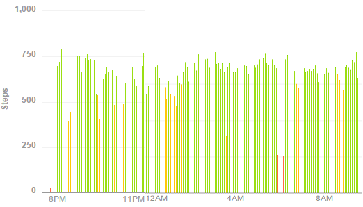
With recent cold spring storms, I chose this weekend to stay in the lowlands for a long run. The day before I got the idea of running all the way around massive Cedar Valley which lies about five miles west of my home. It is mostly flat, 23×7 miles and surrounded on all sides by mountains. Because my wife was gone for the evening, I decided to make this a night training run that mentally should help me in my 100 milers as I have had increased difficulty running the entire night without problems.
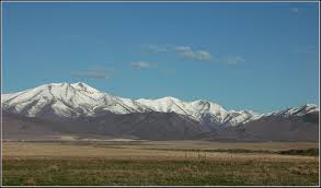
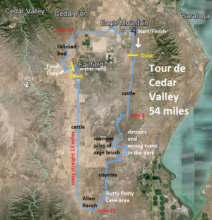
I’ve run in this valley many, many times but the planned a route would take me on a few roads and trails I haven’t explored before. I would run a giant loop in the clockwise direction. I parked my car on the east end of Eagle Mountain city center and took off running south at about 8:00 p.m.
For the first seven mile I ran on a very familiar straight dirt road below the foothills of Lake Mountain. A tailwind pushed me along. The sun went down and it quickly became chilly, causing me to stop to put on another layer and a cap. Usually this valley has an odd inversion during the night where cold air sinks in causing temperatures to dive about 20 degrees below compared to locations in the foothills. I hoped the wind would keep this cold away. I started running at about a 9:30 pace but soon slowed to a comfortable 11-minute pace.
As the dark surrounded me, I heard the pounding of cattle feet that I was stirring up. I would see groups of cattle in the road ahead and most of them ran away before I arrived. But one group stood their ground. It was led by a big long horn steer that looked very imposing and had very sharp horns. I had heard about mean bulls in this area so I was careful, stopped and walked, and shined my light on him. Soon he moved away and the others followed. I ran on but it was rather uncomfortable hearing pounding feet on both sides of me, wondering if some long horns would soon jab me from behind. After the next cattle guard they were gone.
At about mile seven I left the main dirt road and ran on a powerline road. I saw to the east the lights of some vehicles coming down from Soldier Pass, probably to camp for the night and shoot in the morning. As I ran on, I watched the lights of one jeep that stopped at the junction of the powerline road behind me. They started shining bright lights toward me. Soon they started to follow. Why? There was nothing down this route for them. Why were they following me? This motivated me to run faster. Somewhat alarmed I turned my headlamp off and ran by the starlight. When I did that, they would stop and shine their headlights in my direction. When I turned my light back on, they kept coming.
I made a turn west at mile 8.3 and then ran hard to put some distance on them. Surely they wouldn’t turn and instead would continue down the more defined powerline road. But after another mile, they did turn and continue to follow me. I couldn’t find my next turn (I didn’t go quite far enough) so I turned on a faint motorcycle trail. I hoped it would link up with my next road. I used the stars above and Eagle Mountain lights at my back to help me stay heading south. I also watched jets in the sky flying in from the south. I was on their flight path to the Salt Lake airport.
I worried that I would be wandering slowly around in this desert valley all night but soon I came upon a dirt road and was able to rejoin my planned route. Lights continued to shine toward me and I was astonished that they kept finding roads to follow me. I finally hit a ranch road that should take me several miles south and I ran hard to get away. My pursuers found the road I was on and kept coming but I was now more than a mile ahead. Soon they stopped, would occasionally shine lights toward me but no longer were coming.
I came to a junction was puzzled which way was right (took the wrong way) and continued. My road soon was going too far east and I realized that was now off course and would need to improvise. I was in a section of the valley that I never had run in, but knew what was in all directions if I just continued on, tried to keep heading south. I wasn’t really lost, but just didn’t know where the roads were taking me. Orion was low in the sky to south and I used those stars and others to guide me.
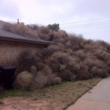
Eventually I was pretty convinced I was on the right road but then I hit a major obstacle. During the past week we had some terrible wind storms. Up against fence lines in this area were monster high piles of tumble weeds. My route needed to pass through, but it was impossibly blocked by pilea taller than my head. If I attempted to go through, I would be cut up and scratched terribly. I had no choice but to reverse course, head east, and find a new road to take me south.
As I ran east, giant piles of sage brush blocked any possible routes to the south. I continued all the way to the powerline road which I had run before but heads southeast. I reached the hills north of the Nutty Putty Cave region. I knew this region had many mining roads but they were unfamiliar. I picked one to take me south and I ran along the hill tops with still a view of Eagle Mountain lights 12 miles to the north. (I was now actually on a good course, just a half mile to the east of a road I had planned to run.) But at one point I stopped and asked out loud, “Where am I?”
I continued on, still using stars to guide me. I finally hit a familiar area but new fence lines had been installed since I had run here about eight years ago. Things were different, former roads were gone. I decided to just run along a fence line on a faint fun deer trail. Eventually I arrived at the hill containing the closed Nutty Putty cave. (The cave used to be a common adventure area, but several years when a guy got stuck in it and died, they closed the cave for good, still containing the body). Again things were different here because of new fence lines but I continued to run south and finally hit the very familiar Chimney Rock road. I should have been at this point at mile 19.6, but because of my detours I had covered 24.1 miles.
Now my concern was the cold temperatures. The jacket I brought had come off my little pack when I went under a fence. I had carried it, but dropped it somewhere. As I descended down in the valley it became colder. Also my water supply was getting low. I had brought about the equivalent of four bottles with a resupply point at mile 37, but that would now be at mile 41. I decided to change my course ahead and not travel as far west as I planned to those foothills. Instead I would take the long 13-mile straight road to the little town of Fairfield with Camp Floyd State Park and its heated bathroom.
I ran by Allen Ranch at the south end of the valley, the lights of which I had seen on off all night. I was getting pretty cold, ate more, and soon felt better as I made the turn north and no longer had a head wind. The stars above were now exploding in the sky. At times I turned out my light to just look at the amazing sight. To the east on the other side of the valley in the hills about four miles away were a couple groups camping, still up at about 3 a.m. One group saw my light, and followed me along by shining a green laser toward me for several miles.
The long 13-mile straight road tried to mess with my mind, the town lights ahead never coming closer. I thought this was ideal training for next week’s Salt Flats 100 when we would run 14 miles across the salt. I ran by a lingering camp fire, from some kids camping out in the valley. My pace wasn’t great but a consistent 14-minute pace. Finally the town came and I ran to the heated bathroom to recover and warm up. It was so nice. I was at mile 40.4. I refilled my bottles and rested for about 15 minutes until I was ready to go on.
I next headed west on the main highway toward Five-mile Pass. I reached my food drop at Manning Canyon road, ate and drank plenty and continued on. The dawn had arrived and a beautiful morning appeared. The temperature warmed as I ran on an old mining rail bed toward the town of Cedar Fort. I enjoyed looking at rotting railroad ties scatters on the left and remains of little bridges. It was great fun. I saw occasional antelope who trotted away. My original plan was to run to the far north end of the valley but that would extend my run into the afternoon and I was ready to head home, so instead I decided to run straight across the valley to my car and call it good. I reached the 50-mile point when I reached the historic Pony Express route at 12:48. My pace wasn’t blazing fast, but solid for a training run with all its various challenges.
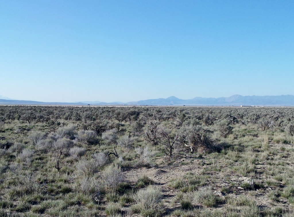
I enjoyed a leisurely run near the homes in Eagle Mountain and greeted a few runners out for the morning. My car came in sight and I was finally finished, running nearly 54 miles all around the valley. My elapsed time was 13:36 and my moving time was 13:10. It had been a wonderful adventure with some amazing twists and turns. A great accomplishment. This was my 14th run this year (in 16 weeks) of running at least 34 miles.
